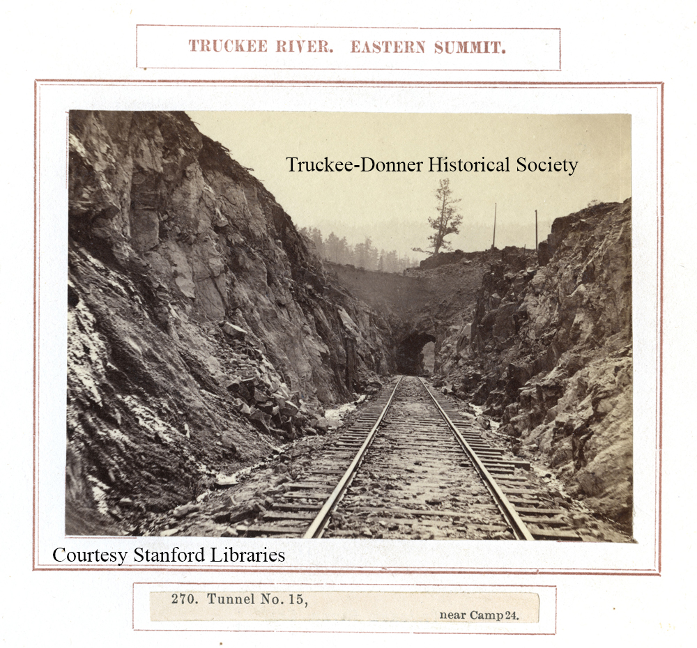
Notes: Original image is 3.7 MB. HCS 1/16/2022. Image at Stanford site. See also Goldbaum and Huffman's 2012 book, Waiting for the Cars, p. 300. The authors explain that Tunnel 15, at 94 feet, was just two feet longer than the shortest tunnel on the railroad, tunnel no. 4. The authors added that numerous state boundary surveys were reevaluated from established observatories. Notably, an 1872 survey by Alexey Von Schmidt demonstrated that the 1863 line was 3,000 feet too far WEST. Surveyor Schmidt subsequently marked the NEW state line that is still recognized today. And yet there remains a discrepancy with the National Register of Historic Places 1980 Inventory Form which suggests that the boundary line was but 1,600-1,800 feet too far west. Nonetheless, Von Schmidt's 1872 survey has been long accepted as the definitive state boundary, in spite of the later 1893 survey contesting that boundary as well.
Rights: NOT FOR SALE; research only
Identifier: AAH0082
Serial Number: 2136
Donation: Alfred A. Hart Collection (AAH) collection (#34)